
Optimization of the Spatial Layout of Logistics Supply Chain Nodes in the Capital Circulation Circle
Received date: 2019-04-30
Revised date: 2020-03-22
Online published: 2025-04-01
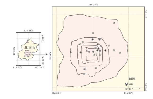
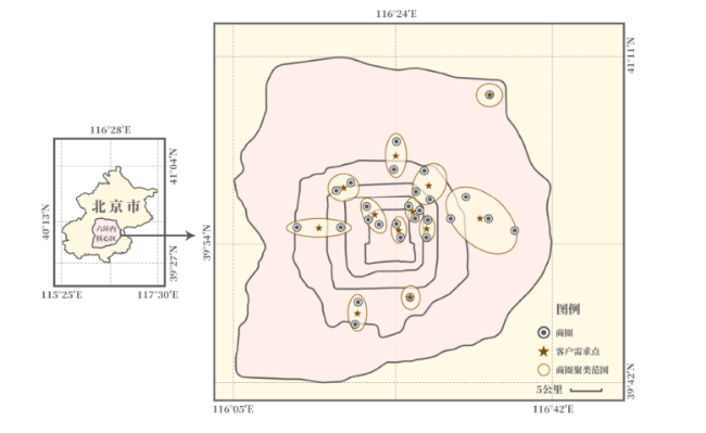
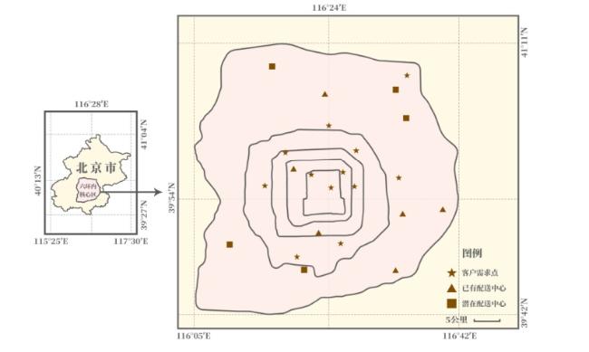
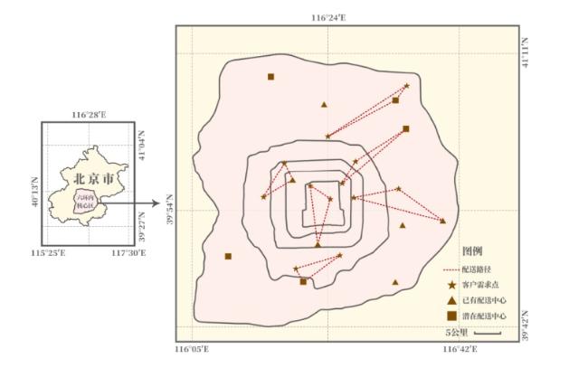
Under the spontaneous adjustment of the market mechanism,we should exert the influence of government regulation,integrate the logistics and distribution resources of the Beijing-Tianjin-Hebei region,and construct the logistics supply chain system of agricultural products in the capital circulation circle based on the "one core" consumer market orientation with the "double-layer + multi-center" logistics distribution nodes according to Beijing-Tianjin-Hebei regional traffic network. The CLRIP integrated optimization method is used to coordinate and optimize the distribution center locations,distribution routes and inventory control of the agricultural product logistics supply chain around the capital ring,and establish the optimization model of the spatial layout of logistics supply chain nodes. With reference to Winner Big Data,the 27 business districts within Beijing's Sixth Ring Road are used as customer points,and the existing distribution centers and proposed distribution centers near Beijing's Sixth Ring Road are used as alternative distribution centers to verify the feasibility and practicality of the optimization model which would provide the optimal spatial location layout,distribution routes and inventory levels for the distribution centers on the agricultural product logistics supply chain in the capital circulation circle to achieve the most preferable address-path-inventory and to form a number of "group" Logistics Supply chain node space layout under the controllable cost.
CHEN Hongli , ZHAO Shuang , YANG Haibo , ZHANG Lili . Optimization of the Spatial Layout of Logistics Supply Chain Nodes in the Capital Circulation Circle[J]. Economic geography, 2020 , 40(7) : 115 -123 . DOI: 10.15957/j.cnki.jjdl.2020.07.013
表1 所有备选配送中心点位置及成本参数(单位:元)Tab.1 Alternative distribution center point locations and cost parameters(Unit:Yuan) |
| 备选配送中心点j | 坐标 | 选址成本Fj |
|---|---|---|
| 1 | (117,30) | 18 980 000 |
| 2 | (138,73) | 14 600 000 |
| 3 | (121,70) | 43 800 000 |
| 4 | (75,140) | 48 180 000 |
| 5 | (55,98) | 56 940 000 |
| 6 | (67,54) | 18 720 000 |
| 7 | (72,35) | 15 780 000 |
| 8 | (18,45) | 949 000 |
| 9 | (40,158) | 4 500 000 |
| 10 | (118,148) | 1 168 000 |
| 11 | (120,125) | 1 224 000 |
表2 12个客户需求点的坐标位置和日均需求量(单位:t)Tab.2 End store customer point parameters(Unit:ton) |
| I | 坐标 | |||
|---|---|---|---|---|
| 1 | (77,84) | 230 | 248 | 260 |
| 2 | (75,122) | 183 | 200 | 224 |
| 3 | (90,83) | 216 | 262 | 271 |
| 4 | (90,106) | 260 | 316 | 318 |
| 5 | (55,39) | 154 | 169 | 196 |
| 6 | (83,49) | 138 | 159 | 170 |
| 7 | (62,91) | 265 | 278 | 308 |
| 8 | (120,90) | 211 | 247 | 267 |
| 9 | (85,92) | 278 | 286 | 319 |
| 10 | (138,160) | 117 | 134 | 140 |
| 11 | (36,85) | 150 | 173 | 187 |
| 12 | (49,117) | 202 | 214 | 263 |
表3 环首都配送中心CLRIP模型初始解和最优解的目标函数值(单位:元)Tab.3 The objective function value of the initial solution and the optimal solution of the CLRIP model of the Capital Distribution Center(Unit:Yuan) |
| 序号 | 初始解目标函数值 | 最优解目标函数值 | 偏差(%) |
|---|---|---|---|
| 1 | 275 524 000 | 225 930 000 | 0.18 |
| 2 | 253 740 000 | 225 830 000 | 0.11 |
| 3 | 250 930 000 | 225 840 000 | 0.10 |
| 4 | 272 170 000 | 225 900 000 | 0.17 |
| 5 | 253 920 000 | 225 990 000 | 0.21 |
| 6 | 259 470 000 | 225 740 000 | 0.13 |
| 7 | 282 210 000 | 225 770 000 | 0.20 |
| 8 | 242 790 000 | 225 800 000 | 0.07 |
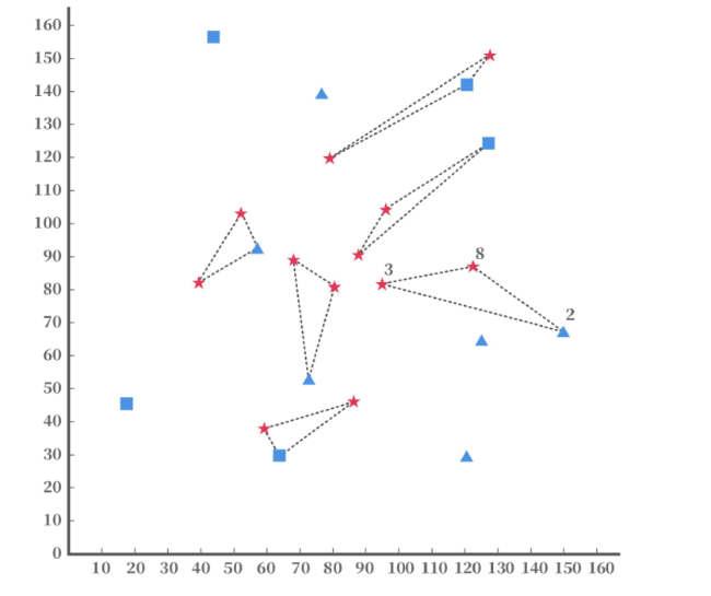
表4 环首都流通圈鲜活农产品配送系统CLRIP模型的最优解(单位:元)Tab.4 The optimal solution of CLRIP model for fresh agricultural products distribution system in the Capital Circulation Circle(Unit:Yuan) |
| 最优成本/元 | 开放的配送中心 | 路径 | T/d | ||
|---|---|---|---|---|---|
| 选址成本 | 108 432 000 | 2 | 8→3 | 36 | 12 250 |
| 5 | 11→12 | 36 | 8 417 | ||
| 库存成本 | 113 595 000 | 6 | 1→7 | 36 | 11 806 |
| 7 | 5→6 | 36 | 8 749 | ||
| 运输成本 | 3 713 000 | 10 | 2→10 | 36 | 10 057 |
| 11 | 4→9 | 36 | 14 443 | ||
| 总成本 | 225 740 000 | ||||
| [1] |
|
| [2] |
|
| [3] |
韩增林, 李晓娜. 第三方物流企业的区位影响因素研究[J]. 地域研究与开发, 2007, 26(2):16-25.
|
| [4] |
曹卫东. 城市物流企业区位分布的空间格局及其演化——以苏州市为例[J]. 地理研究, 2011, 30(11):1 997-2 007.
|
| [5] |
梁双波, 曹有挥, 吴威. 上海大都市区港口物流企业的空间格局演化[J]. 地理研究, 2013, 32(8):1 448-1 456.
|
| [6] |
秦璐, 高歌. 中国物流运营网络中的城市节点层级分析[J]. 经济地理, 2017, 37(5):101-109.
|
| [7] |
蒋天颖, 史亚男. 宁波市物流企业空间格局演化及影响因素[J]. 经济地理, 2015, 35(10):130-138.
|
| [8] |
|
| [9] |
崔广彬, 李一军. 基于双层规划的物流系统集成定位—运输路线安排—库存问题研究[J]. 系统工程理论与实践, 2007(6):49-55.
|
| [10] |
马汉武, 朱晖. 基于JITD的服务备件二级分销网络集成研究[J]. 工业工程, 2011, 14(6):76-80.
|
| [11] |
陈德慧, 陈东彦. 模糊随机环境下B2C电子商务配送系统CLRIP集成优化模型[J]. 系统管理学报, 2017, 26(4):744-753.
|
| [12] |
唐金环, 戢守峰, 蓝海燕, 等. 考虑碳配额差值的选址—路径—库存联合优化多目标模型与求解[J]. 管理工程学报, 2017, 31(1):162-168.
|
| [13] |
北京市商务委, 天津市商务委. 河北省商务厅环首都1小时鲜活农产品流通圈规划[R]. 2017.
|
| [14] |
梁双波, 曹有挥, 吴威. 长江三角洲地区物流供应链时空演化及其影响因素——基于国际货代企业数据的分析[J]. 地理研究, 2017, 36(11):2 156-2 170.
|
| [15] |
郑哲文. 基于可靠技术的应急物流供应链构建[J]. 中国流通经济, 2009, 23(10):54-56.
|
| [16] |
夏佐铎, 谭亮. 北京奥运物流供应链的构建[J]. 商业研究, 2008(2):126-129.
|
| [17] |
李晓宇, 张明玉. 农产品物流供应链风险生成机制及预警模式[J]. 管理现代化, 2009(4):47-49.
|
| [18] |
|
| [19] |
北京市商务委员会, 北京市发展和改革委员会. 北京市“十三五”时期物流业发展规划[R]. 2016.
|
/
| 〈 |
|
〉 |